Saint Romain between panoramic views and history
SAINT-ROMAIN-DE-LERPS
Saint Romain between panoramic views and history
Medium
3h30
11,2km
+313m
-309m
Loop
Embed this item to access it offline
From the lush green setting of Château du Besset to the spectacular panorama from the Pic viewpoint, the diversity of the landscapes will amaze you at every turn.
Description
- Town hall: Take the GR42, then the tarmac road that crosses the village and follow signs for Le Pin.
- Helios: Leave the GR 42 on the right, leaving the village and its beautiful houses with shaded gardens behind you. The signposts are few and far between, but continue along the road, which offers beautiful views of the Ardèche hills.
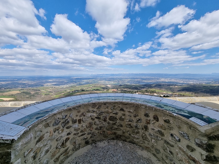
- Croix de Cerisier: On the left, you will discover a beautiful view of the Rhône valley. Weather permitting, you can see Mont Ventoux or the Oisans massif. Closer to us are the foothills of the Vercors. Continue 500 metres along the road until you reach the next hiking sign.
- Chemin de Cerisier: Continue straight ahead on the tarmac road for 100 metres.
- Serre du Sabot: take the path on the right, a steep descent through woods towards the Château du Besset, which you can see below. The path leads to a small road. Follow it for a few metres to the left, then take the first path on the right that leads into the fields. Continue to the entrance of the private property of Château du Besset and take the small path that descends to the right towards a pretty bridge over the Ozon. Cross the meadows to the hamlet of Chazal and walk through it.
- Chazal: A very pretty stone hamlet, where you will find a bread oven, as in many farms in the area. This feature inspired the inhabitants to create "La ronde des Fours", a wonderful event that takes place every year in April.
- L'Ubac: Go up Serre Long on the right, following the GR 420.
- Serre Long: Cross the D287, keeping to the path opposite.
- Preaux: Head towards Saint Romain de Lerps - flats opposite.
- Chemin du Serre Long: Continue on the tarmac road opposite and cross the hamlet of Beauliac.
- Les terres grasses: Take the GR 42 on the right towards Saint Romain de Lerps.
- Les Combes: Turn right and continue for 300 metres before reaching the Pic.
- Le Pic: Make a short round trip to the viewpoint and enjoy the view and orientation tables before heading back down to the village.
- Departure : Mairie, Saint Romain de Lerps
- Arrival : Mairie, Saint Romain de Lerps
- Towns crossed : SAINT-ROMAIN-DE-LERPS, CHAMPIS, and SAINT-SYLVESTRE
Forecast
Altimetric profile
Access and parking
D287 depuis Saint-Péray
Report a problem or an error
If you have found an error on this page or if you have noticed any problems during your hike, please report them to us here: